![]()
Consulting Services
Since 1975
Project Listing: Geomatics
Site Navigation
![]() Each Bercha
Group project is preceded by its project number.
Although the work carried out for many of the projects spans a number of
years, most are listed according to project number.
Each Bercha
Group project is preceded by its project number.
Although the work carried out for many of the projects spans a number of
years, most are listed according to project number.
![]()
![]()
![]()
![]()
![]()
![]()
![]()
![]()
|
Project Quick Links |
Projects will
be updated on an ongoing basis. When first
added, new projects will be indicated as shown:
![]()
Projects that
are currently underway are indicated "ongoing" as shown:
![]()
Links to Projects by Year
|
|
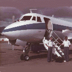
CLUBROOT CLIENT: Enbridge DATE: 2008 DESCRIPTION: The project was a combined risk and geomatics project involving the development of methodologies for the detection of clubroot infected canola fields. The primary application of the detection is the protection of uninfected fields from possible transmission of infected soils through pipeline construction machinery movements along the pipeline route. |
||||||||||||
|
R2805 |
ICETECH 2008 International Conference and Exhibition
Wrap Up |
||||||||||||
|
R2615 |
ICETECH
2008 International Conference and Exhibition on Performance of
Ships and Structures in Ice |
||||||||||||
|
High Consequence Areas
Identification and Ranking DESCRIPTION: In risk assessment two principal aspects are addressed - the probability of occurrence and the magnitude of adverse consequences of an undesired event such as an oil spill. Regardless of probability of occurrence, if the consequences are high, such as multiple fatalities, the location where this can happen is termed a High Consequence Area (HCA). The client has undertaken to identify all such areas along its pipeline in order to undertake mitigation of these high consequences through appropriate mitigation methods. In this study, the following principal areas are addressed: - A working definition of HCAs is developed - A methodology for identification of the HCAs is defined - An identification of HCAs for the pipeline is conducted
- Approaches to HCA mitigation are developed
|
|||||||||||||
|
R2315 |
ICETECH-06 International Conference and
Exhibition CLIENT: Society of Naval Architects and Marine Engineers (SNAME) DATE: July 16-19, 2006 DESCRIPTION: Dr. Bercha chaired the Organizing Committee for ICETECH 2006, an international conference and exhibition on performance of ships and structures in ice, held in Banff, Alberta, Canada, July 16-19, 2006. The theme and subject areas of the conference complemented and derived impetus from the current rapid growth of development and associated resurging interest in oil and gas exploration and production in Arctic offshore regions. |
||||||||||||
| R2003 |
Airborne
Laser Topographic Mapping System National Petroleum Company, Tehran, Iran |
||||||||||||
| R2002 |
Military
SAR and High Resolution Imaging System Development Ministry of Defence, Sri Lanka |
||||||||||||
| 1999 | |||||||||||||
| R9904 |
Risk Assessment of Alternative Road Routes to Lethbridge Water
Treatment Plant CLIENT: Reid Crowther & Partners Ltd. DATE: 1999 DESCRIPTION: A risk assessment for alternative routings for hazardous chemical carrying trucks accessing the Lethbridge Water Treatment Plant was conducted. The assessment included evaluation of low and high-speed intersections, park roads, urban roads, and a turnoff ramp from Whoop-Up road. |
||||||||||||
| R9902 |
Airborne
SAR Surveillance System Design and Specification For Ministry of Defence, Sri Lanka, with Kelowna Flightcraft Ltd. |
||||||||||||
| 1998 | |||||||||||||
| R9803 |
Airborne
Laser Route Topographic Mapping System Design and Specification
ATRAK Energy Limited |
||||||||||||
| R9802 |
Detailed
Design and Specification of Aerial Multi-Purpose Surveillance
System for Malaysian Government Mofaz Group, Kuala Lumpur, Malaysia |
||||||||||||
| 1997 | |||||||||||||
| R9709 |
Preliminary Design of Maritime Airborne Surveillance Program for
Malaysian Exclusive Economic Zone Malaysian Department of the Environment |
||||||||||||
| R9703 |
Interpretation of ERS-1 Images Amoco Worldwide Engineering and Construction Ltd. Houston, TX, USA |
||||||||||||
| R9701 |
SPOT Image
Mapping, N.W.T. Ranger Oil Ltd. Calgary, Alberta, Canada |
||||||||||||
| 1996 | |||||||||||||
| R9604 |
Digitizing
and Conversion of Survey and Map Coordinates Chauvco Resources Ltd. Calgary, Alberta, Canada |
||||||||||||
| R9602 |
ERS-1 and
Landsat Thematic Mapper Image Mapping Komex International Inc. Calgary, Alberta, Canada |
||||||||||||
| R9601 |
Conversion
Of Digital Elevation Data Formats Canadian Occidental Petroleum Ltd. Calgary, Alberta, Canada |
||||||||||||
| 1995 | |||||||||||||
| R9515 |
Licensing,
Support and Training For ERMapper Software Various Clients |
||||||||||||
| R9514 |
Conversion
Of ERS-1 Image Formats Komex International Inc. Calgary, Alberta, Canada |
||||||||||||
| R9511 |
Digitising
and Conversion Of Map Coordinates Chauvco Resources Ltd. Calgary, Alberta, Canada |
||||||||||||
| R9507 |
SPOT Image
Mapping, Algeria PetroCanada Resources Ltd. Calgary, Alberta, Canada |
||||||||||||
| R9503 |
Feasibility Study For Remote Sensing Environmental Monitoring Of
Pipeline Rights-of-Way National Energy Board Calgary, Alberta, Canada |
||||||||||||
| R9502 |
Conversion
Of Survey and Map Data For Input To ARGUS Mapping System
Chauvco Resources Ltd. Calgary, Alberta, Canada |
||||||||||||
| 1994 | |||||||||||||
| R9425 |
SPOT
Multispectral Image Deskewing University of Calgary Calgary, Alberta, Canada |
||||||||||||
| R9424 |
Landsat TM
and SPOT Panchromatic Image Mapping for Libya PanCanadian Petroleum Ltd. Calgary, Alberta, Canada |
||||||||||||
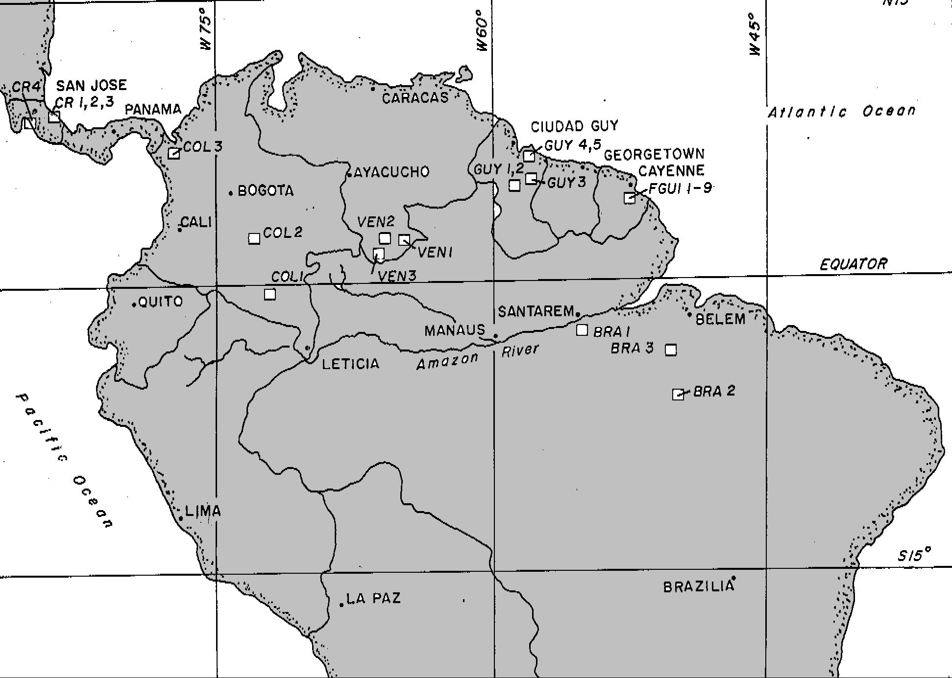
| R9423 |
Airborne
SAR Image Processing and Mapping United Nations Development Programme Georgetown, Guyana |
||||||||||||
| R9422 |
Kara Sea
Russian SLAR Image Processing and Ice Interpretation Amoco Petroleum Co. Ltd. Tulsa, Oklahoma, USA |
||||||||||||
| R9420 |
SPOT
Panchromatic Image Mapping of Northern B.C. Norcen Resources Ltd. Calgary, Alberta, Canada |
||||||||||||
| R9419 |
Landsat
Thematic Mapper and SPOT Panchromatic Image Mapping of Turkey
Chauvco Resources Ltd. Calgary, Alberta, Canada |
||||||||||||
| R9418 |
SPOT
Panchromatic Image Mapping of the Slave Lake Area, Alberta
Morgan Hydrocarbons Calgary, Alberta, Canada |
||||||||||||
| R9414 |
Image
Processing of Northumberland Strait Crossing Geomatic Technologies Inc. St. John's, Newfoundland |
||||||||||||
| R9413 |
Russian
SLAR and ERS-1 Image Processing of Pechora Sea, Russia Amoco Petroleum Ltd. Tulsa, Oklahoma, USA |
||||||||||||
| R9412 |
Landsat TM
Image Mapping of the Chinchaga Area, Alberta Amoco Canada Petroleum Co. Ltd. Calgary, Alberta, Canada |
||||||||||||
| R9411 |
SPOT
Panchromatic Image Mapping of Nacunen, Argentina Norcen Resources Ltd. Calgary, Alberta, Canada |
||||||||||||
| R9407 |
Remote
Sensing for Geology Workshop Canadian Sedimentary and Petroleum Geologists Conference Calgary, Alberta, Canada |
||||||||||||
| R9404 |
Landsat TM
Image Mapping and Geological Interpretation of Blackfoot,
Montana Numac Petroleum Ltd. Calgary, Alberta, Canada |
||||||||||||
| R9402 |
Landsat
MSS Image Mapping of Lacombe County, Alberta LR Olson and Associated, Ltd. Rocky Mountain House, Alberta, Canada |
||||||||||||
| 1993 | |||||||||||||
| R9332 |
SPOT
Panchromatic Image Mapping of Lago Pellegrini Este, Argentina
Chauvco Resources Ltd. Calgary, Alberta, Canada |
||||||||||||
| R9331 |
SPOT
Panchromatic Image Processing and Mapping of the Covunco Block,
Argentina Alberta Energy Company Calgary, Alberta, Canada |
||||||||||||
| R9323 |
Landsat
MSS Image Processing and Mosaicking of Benin ABACAN Calgary, Alberta, Canada |
||||||||||||
| R9322 |
SPOT
Panchromatic Image Processing and Mapping of Neuquen, Argentina
Chauvco Resources Ltd. Calgary, Alberta, Canada |
||||||||||||
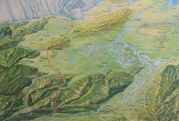
| R9318 |
Seminar
on Remote Sensing Project Management and Applications for
Environmental Monitoring
DESCRIPTION: The Bercha Group formulated
curriculum, produced a manual, and conducted a technical seminar
in Caracas, Venezuela as part of a Public Safety and
Environmental Risk Management seminar series conducted in
association with Geoexpert C.A. of Caracas. The three-day
technical seminar covered a wide range of subjects, including:
an introduction to remote sensing, general examples for
environmental monitoring, sensor systems and airborne
acquisition platforms, satellite sensors, manual interpretation,
digital image processing, methods of map production from
remotely sensed imagery, and applications to environmental
monitoring. Although conducted in English, simultaneous
translation occurred during the seminar, and seminar materials
were available in both Spanish (Figure 1) and English.
|
||||||||||||
| R9317 |
Vegetation
Change Detection using LANDSAT MSS Imagery in the Cold Lake
Region, Alberta Amoco Canada Petroleum Co. Ltd. Calgary, Alberta, Canada |
||||||||||||
| R9309 |
Thematic
Mapper Image Processing, Tunisia Wascana Resources Limited |
||||||||||||
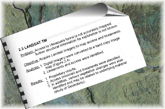
| R9308 |
Satellite
Data and SAR Processing for Mineras Estratos E. Valero, Venezuela |
||||||||||||
| R9305 |
Satellite
Data and SAR Processing for Marawani Concession Organization Cisneros, Venezuela |
||||||||||||
|
R9303 .01 |
Risk
Based Siting and Permitting of Hazardous Energy Related
Facilities CLIENT: County of Santa Barbara, California Utilities Commission DATE: 1993-1994 DESCRIPTION: The objective of this study was to develop the basis for a policy on application of risk analysis in the siting and permitting of hazardous energy related facilities in the County of Santa Barbara. General classes of facilities considered explicitly were oil and gas, automotive fuel, and electrical facilities. Only acute or immediate risks as opposed to chronic or long term risks were included in the scope of work. Fundamentals of risk analysis were reviewed to establish a basis and terminology for the balance of the work. The general procedures for implementing risk considerations in the planning process were then described. Results from a review of the general types of hazardous energy related facilities which exist or may exist in the near future in the County of Santa Barbara included: a) classification of the facilities into oil and gas, automotive fuel, and electrical categories and sub-categories such as gasoline, compressed natural gas, methanol, and ethanol stations in the automotive fuel category. b) a brief description of the relative hazardousness of the principal substances handled by the facilities. c) a general description and summary of the hazards associated with each type of facility. d) a review of both US and worldwide guidelines and regulations designed to manage acute risks to the public. e) a discussion of the role of risk analysis in the context of the planning processes for the County of Santa Barbara. f) specific recommendations for the implementation of the results from this work. |
||||||||||||
| 1992 | |||||||||||||
| R9234 |
SPOT
Panchromatic Image Mapping PanCanadian Petroleum Limited |
||||||||||||
| R9232 |
Oil Field
Mapping with High Resolution SPOT Imagery Chauvco Resources Limited |
||||||||||||
| R9229 |
Development of Algorithms for the Interpretation of Digital
Radar Imagery National Research Council of Canada |
||||||||||||
| R9223 |
Satellite
Data of SAR Processing for Rio Icabaru Concession H.I. Gibelli, Venezuela |
||||||||||||
| R9222 |
SPOT Image
Mapping, Alliance, Alberta PanCanadian Petroleum Limited |
||||||||||||
| R9220 |
Rio
Icabaru SAR Survey Golden Star Resources |
||||||||||||
| R9217 |
Digital
Analysis of Multiband Data for Sumatra Asamera and Gulf Canada |
||||||||||||
| R9216 |
Stereo
SPOT DEM Development and Processing Canadian Occidental Petroleum Limited |
||||||||||||
| R9211 |
Analysis
of TM Data for Sumatra Geology Bow Valley Resources |
||||||||||||
| R9207 |
Detection
of Oil Seepage Using Satellite Data Canadian Occidental Petroleum Limited |
||||||||||||
| R9204 |
Identification of Burrowing Owl Habitat Risk in Southern Alberta
Using Landsat TM Imagery: A Preliminary Investigation with GIS
Canadian Wildlife Service |
||||||||||||
| 1991 | |||||||||||||
| R9118 |
SAREX-92
SAR Data Acquisition and Processing
DESCRIPTION: In October of 1991, The Bercha Group with
principal subcontractor Innotech Aviation Limited, was awarded
ESTEC Contract No. 9643/91/NL/S2, entitled “Technical Support
for the Implementation of the SAREX-92 Campaign”.
|
||||||||||||
| R9115 |
Wildlife
Habitat Classification for GIS Analysis Canadian Wildlife Service |
||||||||||||
| R9109 |
Integration and Processing of Satellite Gravity and Magnetic
Data for Offshore Prospect Evaluation Canadian Occidental Petroleum Limited |
||||||||||||
| R9108 |
Landsat TM
Image Interpretation: British Columbia Conoco Canada Ltd. |
||||||||||||
| R9106 |
SLAR Ice
Image Data Management System Software Development Amoco Canada Ltd. |
||||||||||||
| R9105 |
Course on
Applications of Remote Sensing to Geology Petro-Canada Resources Ltd. |
||||||||||||
| 1990 | |||||||||||||
| R9023 |
Feasibility Evaluation of Developing a Processing Capability for
Improved SLAR Resolution National Research Council of Canada |
||||||||||||
| R9020 |
Remote
Sensing Consulting Services Gulf Canada Resources Ltd. |
||||||||||||
| R9012 |
Environmental Impact Assessment for Proposed Expansion of the
Alberta Special Wastes Treatment Centre CLIENT: Alberta Special Waste Management Corporation DATE: 1990/91 DESCRIPTION: Previous projects, PA8519, PA8420, PA8410, and PA8008 all involved various risk analyses which were carried out for different Government of Alberta departments to support the program being developed to treat hazardous wastes within the province. The above referenced project, PA9012, was a continuation of the previous risk assessment work and was required to support an EIA for a proposed expansion of the existing waste treatment centre. Special or hazardous wastes are collected from generators throughout the province and transported directly or through transfer stations to the treatment centre located in Swan Hills, Alberta. The proposed expansion involved a substantial increase in the volume of hazardous wastes being transported on Alberta roadways and therefore a revised transportation risk assessment was included in the proposal EIA. In addition to the accident and spill analyses, consequence analysis of potential spills of hazardous wastes for both the public and environment were included in the scope of work. Risks associated with the existing operation were compared to those estimated for future operations of an expanded facility. Results from the risk assessment were published in the EIA documents and then were presented and defended during public hearings. |
||||||||||||
| R9011 |
Risk Assessment for an Environmental Clean-Up Study of 21
Distant Early Warning (DEW) Line Sites in Canada
|
||||||||||||
| R9004 |
Landsat TM
Interpretation in Papua New Guinea Canadian Occidental Ltd., Calgary |
||||||||||||
| R9002 |
SLAR Ice
Surveillance Service for the Beaufort Sea Canadian Marine Drilling Ltd.
|
||||||||||||
| R9001 |
Earth
Remote Sensing Marketing Strategy Study Department of Regional Industrial Expansion Government of Canada |
||||||||||||
| 1989 | |||||||||||||
| R8914 |
Multisensor System Development for Aquifer Detection Dow Chemicals |
||||||||||||
| R8913 |
SPOT and
SLAR Geologic Interpretation in Sabah Phoenix Resources, Malaysia |
||||||||||||
| R8909 |
Quality
Control Criteria for SAR Ice Imagery Atmospheric Environment Services
|
||||||||||||
| R8906 |
SB-8 SAR
Interpretation Sun Malaysia Petroleum Company, Malaysia |
||||||||||||
| R8904 |
Sarawak
SK-12 SAR Quality Control Offshore Petroleum and Investment Corp., Malaysia |
||||||||||||
| R8901 |
U.S.
Beaufort SLAR Ice Surveillance Arco Alaska |
||||||||||||
| 1988 | |||||||||||||
| R8825 |
Airborne
Forest Inventory Sensing System and Software National Research Council |
||||||||||||
| R8824 |
Canadian
Project Preparation Facility for Laser Topographic Mapping
Applications Canadian International Development Agency |
||||||||||||
| R8823 |
Forestry
Laser Data Acquisition Institute for Technology Development (NASA) |
||||||||||||
| R8822 |
Remote
Sensing Training Program Government of Alberta |
||||||||||||
| R8814 |
Specialized Remote Sensing and Geophysical Training and
Technology Transfer Program Directorate General of Mineral Resources, Govt. of Indonesia |
||||||||||||
| R8810 |
Interpretation of Barents Sea SAR Ice Imagery Mobil Exploration Norway Inc. |
||||||||||||
| R8809 |
Acquisition of Sea Ice SAR Data for the Barents Sea Mobil Exploration Norway Inc. |
||||||||||||
| R8808 |
Sea Ice
SAR Signature Analysis and Interpretation Manual Atmospheric Environment Service, Dept. of Supply and Services |
||||||||||||
| R8806 |
Acquisition and Interpretation of High Resolution SAR Data for
Northumberland Strait Public Works Canada |
||||||||||||
| R8804 |
Northumberland Strait Photographic Data Interpretation Public Works Canada |
||||||||||||
| 1987 | |||||||||||||
| R8714 |
Airborne
Laser System for Forest Mapping Industrial & Regional Development Program Government of Canada |
||||||||||||
| R8708 |
IRAP-M:
Software Development for Airborne Lasers Canadian National Research Council |
||||||||||||
| R8702 |
Feasibility Study for Laser Topographic Mapping Canadian International Development Agency |
||||||||||||
| 1986 | |||||||||||||
| R8605 |
Provision
of SAR Sensor Operators, 1986-1991 Dept. of Energy, Mines and Resources |
||||||||||||
| R8603 |
SAR
Operations - CV580 Energy, Mines and Resources |
||||||||||||
| 1985 | |||||||||||||
| R8512 |
Scientific
and Technical Support for the Definition of Mission Requirements
for a Satellite Equipped with a Synthetic Aperture Radar (RADARSAT)
The Canada Centre for Remote Sensing, Dept. of Energy, Mines and Resources |
||||||||||||
| R8510 |
Davis
Strait, SLAR Survey British Petroleum Resources |
||||||||||||
| R8507 |
IRAP-M:
Investigation of an Airborne Passive Radar Discriminator
Canadian National Research Council |
||||||||||||
| R8504 |
SLAR
Survey British Petroleum Resources |
||||||||||||
| R8503 |
Drew Point
SLAR Imagery D.F. Dickins Associates Ltd. |
||||||||||||
| R8502 |
Airborne
Laser Mapping Pilot Project Government of Indonesia |
||||||||||||
| R8501 |
Airborne
SLAR Surveillance Service - East Coast Joint Industry Project: Participants: Husky/Bow Valley, Mobil Canada, Petro-Canada
|
||||||||||||
| 1984 | |||||||||||||
| R8421 |
Evaluation
of the Technology for Detecting Small Objects at Sea: Airborne
Sensor Platform Ministry of Transport |
||||||||||||
| R8418 |
Latitude
Longitude Digitization Husky/Bow Valley East Coast Project |
||||||||||||
| R8412 |
Assemble,
Integrate and Flight Test a Marine Mammal Remote Sensing System
for a DH6 Twin Otter Fisheries and Oceans, Supply and Services Canada |
||||||||||||
| R8411 |
Evaluation
of Aerial Remote Sensing as an Environmental Monitoring
Technique for Pipeline Corridors NOVA, An Alberta Corporation |
||||||||||||
| R8410 |
Pipeline
SLAR Survey in South Australia South Australia Department of the Environment |
||||||||||||
| R8409 |
1984
Aerial Reconnaissance Study for the Hibernia Development Project
Mobil Oil Canada, Ltd. |
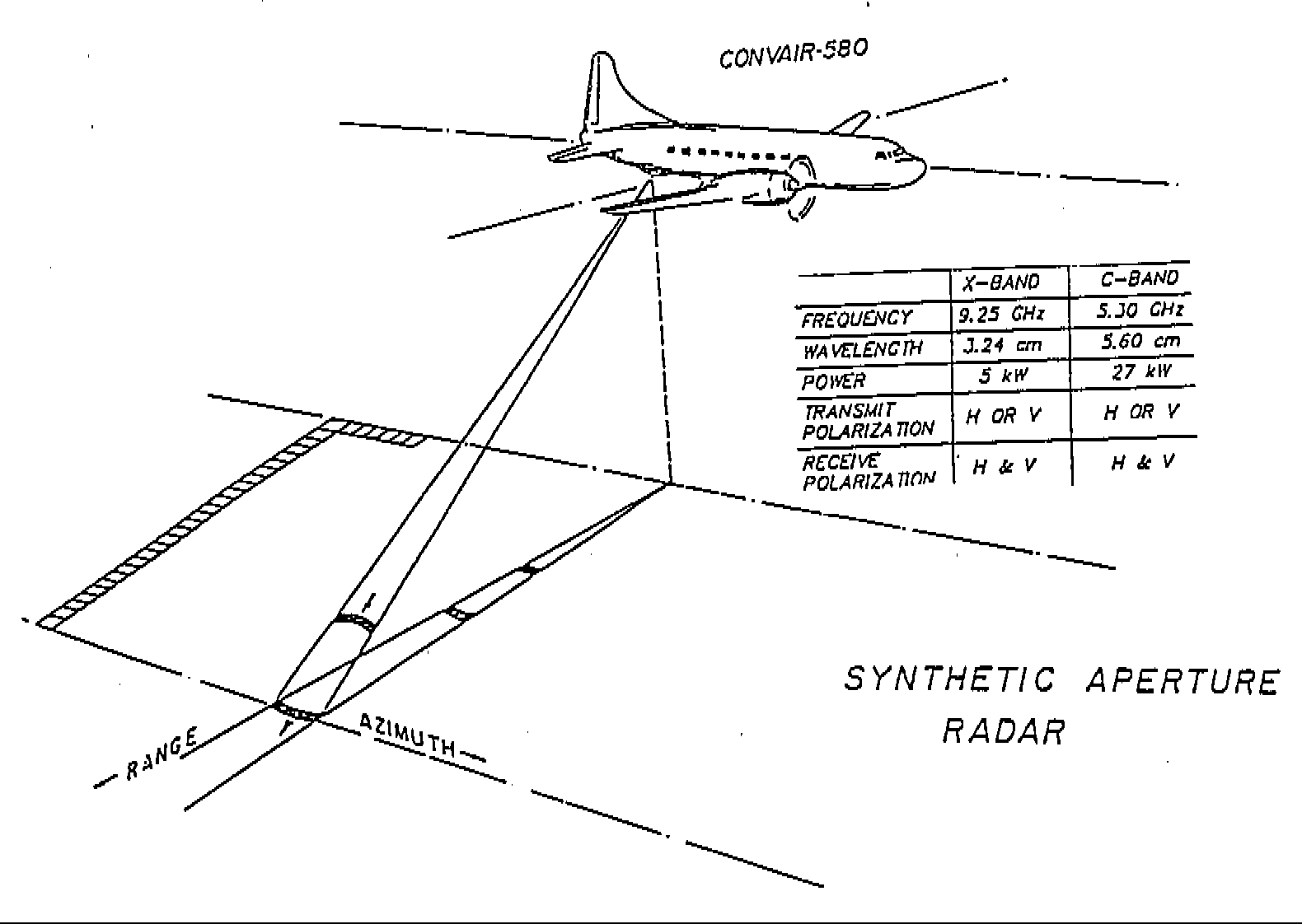
||||||||||||
| R8408 |
Scientific
and Technical Support for the Definition of Mission Requirements
for a Satellite Equipped with a Synthetic Aperture Radar (RADARSAT)
The Canada Centre for Remote Sensing, Dept. of Energy, Mines and Resources |
||||||||||||
| R8407 |
The Influence of Ice on the Reliability of Production Systems in
the Hibernia Oil Field CLIENT: Petroleum Directorate - Government of Newfoundland and Labrador DATE: 1984 DESCRIPTION: The investigation of the effect of ice on the reliability of proposed Hibernia production systems included identification of ice parameters which are significant determinants of system design criteria and evaluation of the effects on system reliability resulting from uncertain estimates of ice parameters and ice loadings. Risk analytic methodologies were developed and applied in the risk and reliability analysis of an example floating production system. |
||||||||||||
| R8406 |
Ice
Processes Analysis - Mizex 1983 U.S. Department of the Navy |
||||||||||||
| R8405 |
Marine
Radar Program Support Viatech Resources Systems Inc. |
||||||||||||
| R8403 |
Iceberg
Aerial Reconnaissance Data Analysis Mobil Oil Canada Ltd. |
||||||||||||
| R8402 |
An
Investigation of Remote Sensing Equipment for Chronic Oil
Discharges Environment Canada |
||||||||||||
| R8401 |
Airborne
SLAR Surveillance Service - East Coast
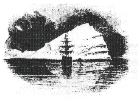
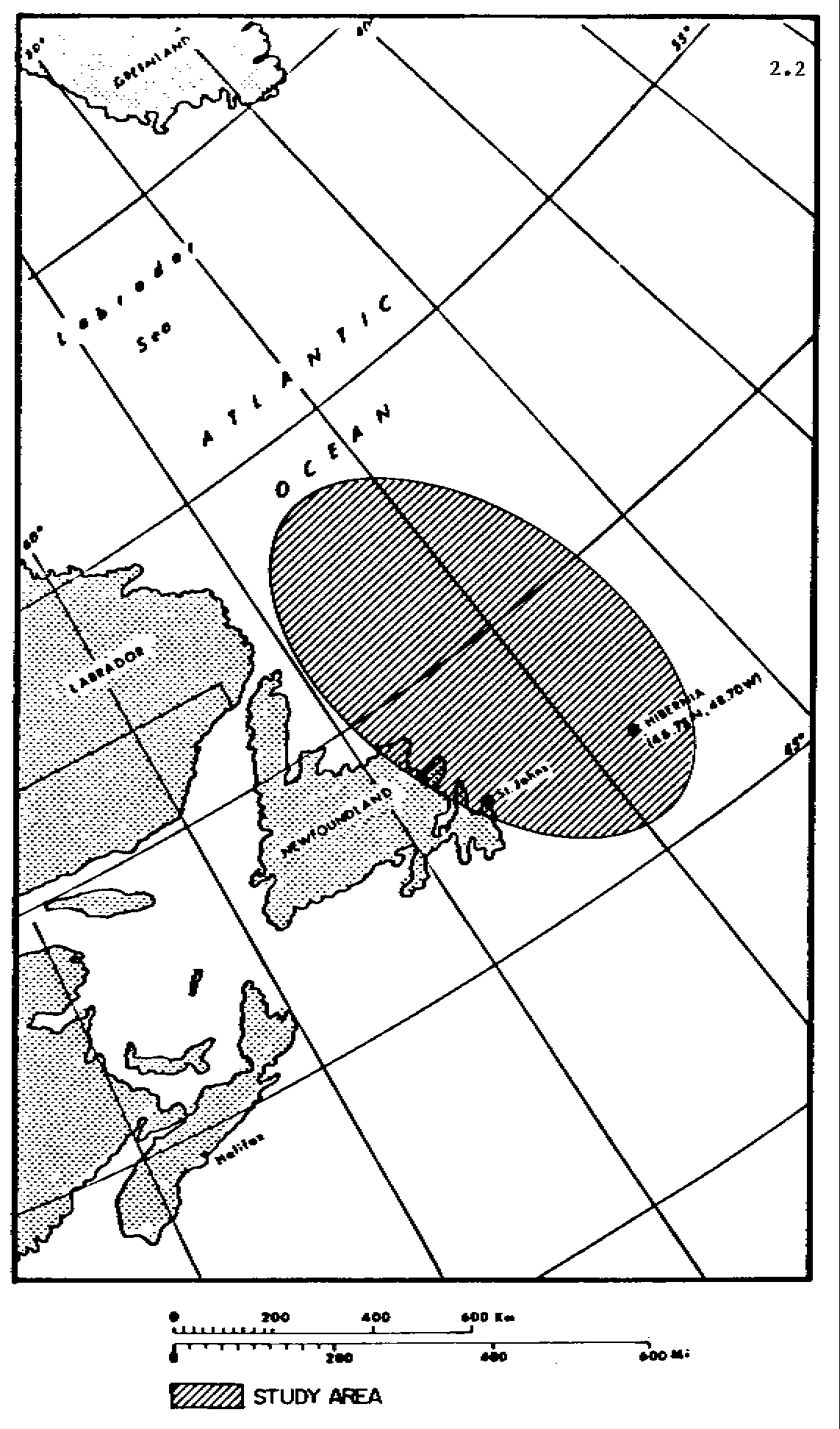
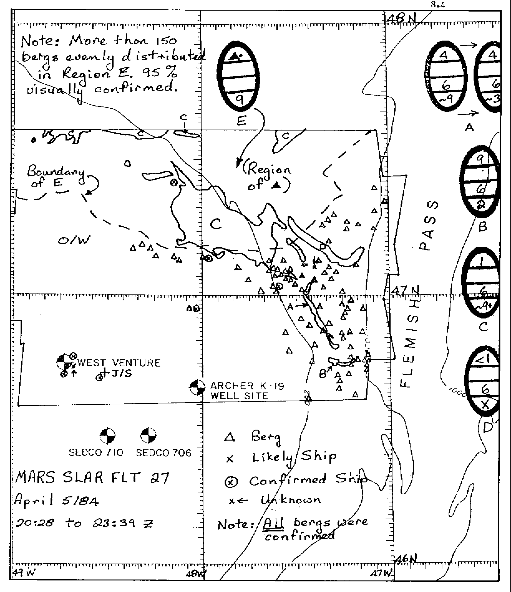
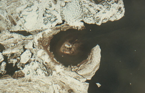
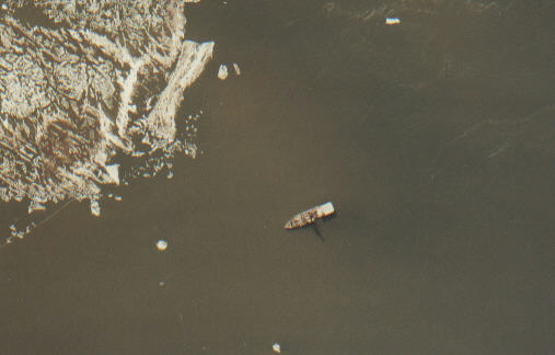
DESCRIPTION: Bercha Group (Bercha) was contracted by
Husky/Bow Valley (H/BV) to provide an ice and iceberg
surveillance program in support of offshore drilling activities
in the Hibernia area (Figure 1) during 1984. This was the first
commercial ice and iceberg operational surveillance program in
the area. The program extended from February 8 to June 30.
During that period, 61 missions were successfully flown in the
study area. The principal objective of the project was to
determine the location of the ice edge and icebergs in the study
and relay this information to H/BV in a timely and efficient
manner (Figure 2).
|
||||||||||||
| 1983 | |||||||||||||
| R8321 |
Directional Wave Spectra Intercomparisons Environmental Studies Revolving Funds (COGLA) |
||||||||||||
| R8319 |
Compilation of Ice Floe Velocities, Pack Ice Motion, Breakout
Events, Multi-Year Ice Fraction, and Ice Edge Locations in the
Chukchi Sea Joint Industry Project: Participants: Amoco, Arco, Chevron, Exxon, Mobil, Phillips, Shell, Sohio, Texaco, Union |
||||||||||||
| R8318 |
Assessment
of Airborne Imaging Radars - Phase II Environmental Studies Revolving Funds (COGLA) |
||||||||||||
| R8316 |
Development of a System for Application of Remote Sensing
Technology and Data to the Estimation of Arctic Marine Mammal
Populations and Distribution
DESCRIPTION: This was a two-phase study directed at
investigation of remote sensing equipment and techniques suited
for Arctic marine mammal studies was conducted for the
Department of Fisheries and Oceans, Western Office. In Phase I,
current and future airborne and satellite remote sensing methods
suitable for marine mammal surveys were reviewed and the
capabilities of each system assessed. Manufacturers of remote
sensing equipment were contacted and sensors displaying suitable
resolution, operating specifications and capabilities were
enumerated. Detection of marine mammals was classified into
three levels; direct detection of actual mammals, indirect
detection of features indicating mammal presence, and habitat
identification. Each sensor capability for detection and
identification of marine mammals was assessed, and the results
were quantified through a sensor capability matrix. Aerial
survey equipment and satellite sensor capabilities were examined
for indirect and habitat detection and identification.
Additionally, Phase I addressed availability of data,
characteristics of platforms and ancillary hardware such as
annotation systems and navigation equipment. Suitable systems
were presented for further study. A map showing the study area
is shown in Figure 1.
|
||||||||||||
| R8313 |
South
Beaufort Sea Pack Ice Edge, SLAR Investigation Joint Industry Project: Participants: Amoco Production Company, Mobil Exploration & Production Services, Shell Development Company, Sohio Petroleum Company |
||||||||||||
| R8312 |
Investigation of Summer Pack Ice Invasion in the South Beaufort
Sea - 1983 Joint Industry Project: Participants: Amoco, Mobil, Shell, Sohio |
||||||||||||
| R8310 |
Compilation of Ice Floe Velocities and Edge Locations and their
Relationship to Surface Weather Patterns in the Navarin Basin,
Bering Sea Joint Industry Project: Participants: Amoco, Chevron, Exxon, Mobil, Phillips, Shell, Sohio |
||||||||||||
| R8305 |
Scientific
and Technical Support for the Definition of Mission Requirements
for a Satellite Equipped with a Synthetic Aperture Radar (RADARSAT)
The Canada Centre for Remote Sensing, Dept. of Energy, Mines and Resources |
||||||||||||
| R8302 |
Mizex
Airborne Data Acquisition Optimization Joint Industry Project: Participants: Arco, Chevron, Sohio |
||||||||||||
| R8301 |
SLAR Ice
Surveillance - Beaufort Sea Drilling Operations Canadian Marine Drilling Limited |
||||||||||||
| 1982 | |||||||||||||
| R8217 |
Ice Floe
Velocity and Edge Locations - Norton Sound, Bering Sea Exxon Company, USA |
||||||||||||
| R8216 |
Flaxman -
West Harrison SLAR Freeze-up Survey Exxon Company, USA |
||||||||||||
| R8214 |
Arctic
Basin Ice Morphology SLAR Investigation Panarctic Oils |
||||||||||||
| R8211 |
Operational Winter Ice Forecast Model Canadian Marine Drilling Ltd. |
||||||||||||
| R8210 |
SLAR
Investigation of Chukchi Sea Ice Dynamics and Morphology
Joint Industry Project: Participants: Amoco, Chevron, Sohio |
||||||||||||
| R8209 |
Beaufort
Sea 1982 SLAR Ice Break-up Dynamics and Morphology Joint Industry Project: Participants: Arco Oil & Gas, Shell, Sohio |
||||||||||||
| R8208 |
SLAR
Aerial Support of South Beaufort Sea Drilling Operations Through
Aerial Support, UHF Downlink, and Field Interpretation Canadian Marine Drilling Ltd |
||||||||||||
| R8207 |
Micro-Densitometric
Decomposition of SLAR Imagery for Evaluation of Ice Cover
Morphological Properties Lapp and Associates Limited |
||||||||||||
| R8206 |
SLAR
Investigation of Chukchi Sea Ice Dynamics and Morphology
Alaska Oil and Gas Operators Association |
||||||||||||
| R8205 |
Investigation of Multi-Sensor Marine Ice Relief in the Bering
Sea and Areas Around Prince Patrick Island Atmospheric Environment Service, Dept. of the Environment |
||||||||||||
| R8204 |
Analysis
of Enhanced LANDSAT Imagery for Resource Management in Ghana
Wordrup, Delowitte, Haskins, and Associates |
||||||||||||
| R8203 |
Remote
Sensor Information for Resource Management Applications Canada Centre for Remote Sensing, Dept. of Energy, Mines, and Resources |
||||||||||||
| R8202 |
Acquisition of Side-Looking Airborne Radar (SLAR) of Wabamun
Lake, Alberta Monenco Consultants |
||||||||||||
| R8201 |
Provision
of Real-Time SLAR Support to South Beaufort Sea Drillships
Canadian Marine Drilling Limited |
||||||||||||
| 1981 | |||||||||||||
| R8122 |
Preliminary Assessment of a Proposal to Establish an
International Satellite Monitoring System Under United Nations
Auspices Department of External Affairs |
||||||||||||
| R8120 |
Study of
Airborne Remote Sensing Requirements and Packages Applicable to
Canadian Needs for Oil Spill Detection and Surveillance Environment Canada |
||||||||||||
| R8117 |
Quantification and Analysis of Ice SLAR Signature
Characteristics Environment Canada, Ice Forecasting Centre |
||||||||||||
| R8116 |
Acquisition and Interpretation of SLAR Ice Imagery Along the
South Beaufort Sea Polar Ice Pack Edge Mobil Oil Corporation |
||||||||||||
| R8115 |
Scientific
and Technical Support for the Definition of Mission Requirements
for a Satellite Equipped with a Synthetic Aperture Radar (RADARSAT)
The Canada Centre for Remote Sensing, Dept. of Energy, Mines, and Resources |
||||||||||||
| R8112 |
Acquisition, Interpretation, and Analysis of Katy's Floeberg
SLAR Imagery Gulf Canada Resources Inc. |
||||||||||||
| R8111 |
Analogue/Digital Conversion of Laser Records of Ice Relief
Profiles Berok Systems Limited |
||||||||||||
| R8108 |
Interpretation of SLAR Ice Imagery for the Norton Sound Area
Joint Industry Project |
||||||||||||
| R8107 |
Ice
Concentration Quantification at Canmar Drillsites Canadian Marine Drilling Ltd. |
||||||||||||
| R8106 |
Evaluation
of Ice Cover Seasonal Variations in South Beaufort Sea
Drillsites on the Basis of SLAR and Satellite Imagery Canadian Marine Drilling Ltd. |
||||||||||||
| R8105 |
Sea Ice
SAR and Aerial Photographic Reconnaissance in the Hibernia Area
Mobil Canada Limited |
||||||||||||
| R8104 |
Remote
Sensing Multi-Sensor Environmental Monitoring Program of
Foothills Pipe Line Right-of-Ways in B.C. and Yukon (MSS-TIR-FCIR
Colour) Foothills Pipe Lines (Yukon) Limited |
||||||||||||
| R8103 |
SLAR
Aerial Support of South Beaufort Sea Drilling Operations
Canadian Marine Drilling Ltd. |
||||||||||||
| R8102 |
Comparison
of SLAR Imagery of the Nearshore Alaska Coastline with
Corresponding Aerial Photography for Microwave Signatures of Sea
Ice Atmospheric Environment Service, Environment Canada |
||||||||||||
| R8101 |
Snow Cover
LANDSAT Imagery, Alpine Ski Area Evaluation Travel Alberta |
||||||||||||
| 1980 | |||||||||||||
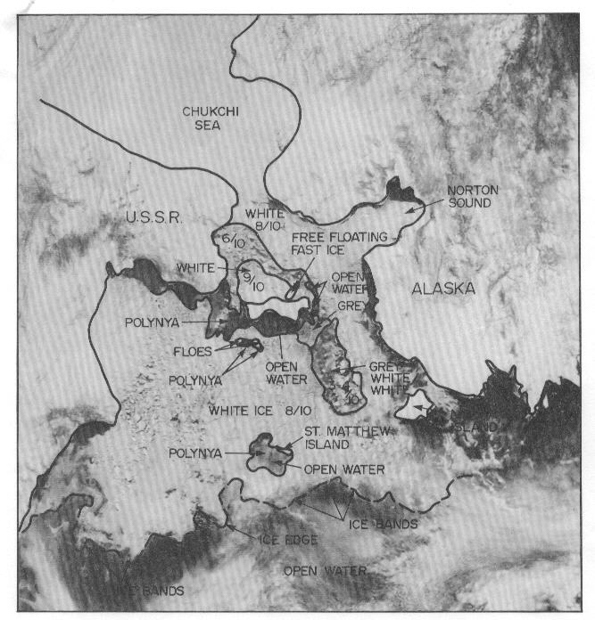
| R8020 |
Acquisition and Interpretation of SLAR Ice Imagery in the Bering
Sea Area Joint Industry Project: Participants: Amoco, Arco, Exxon, Mobil, Phillips |
||||||||||||
| R8015 |
SLAR
Imagery Acquisition and Interpretation of the Yukon Delta
Amoco Production Company |
||||||||||||
| R8012 |
Labrador
Sea Ice Information Compilation and Review Petro-Canada Resources |
||||||||||||
| R8010 |
Preliminary Environmental Impact Statement - Preparation for
Alberta Oilsands Extraction Plant McLeay Geological Services Limited |
||||||||||||
| R8009 |
Acquisition and Interpretation of SLAR Ice Imagery in the
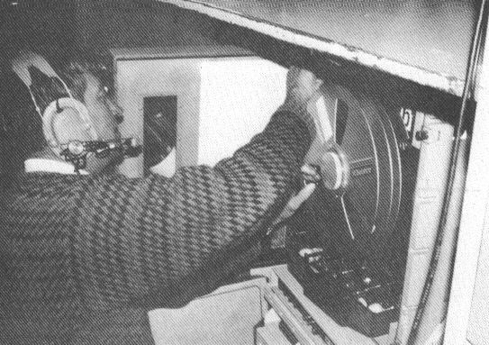
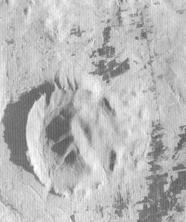
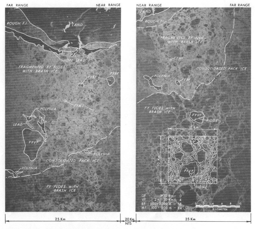
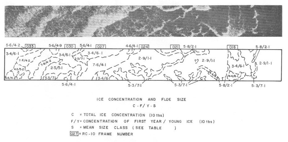
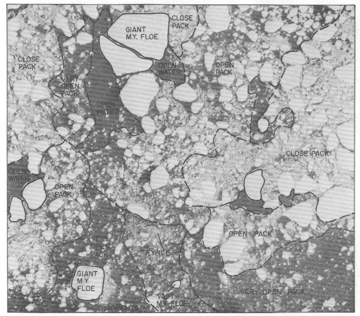
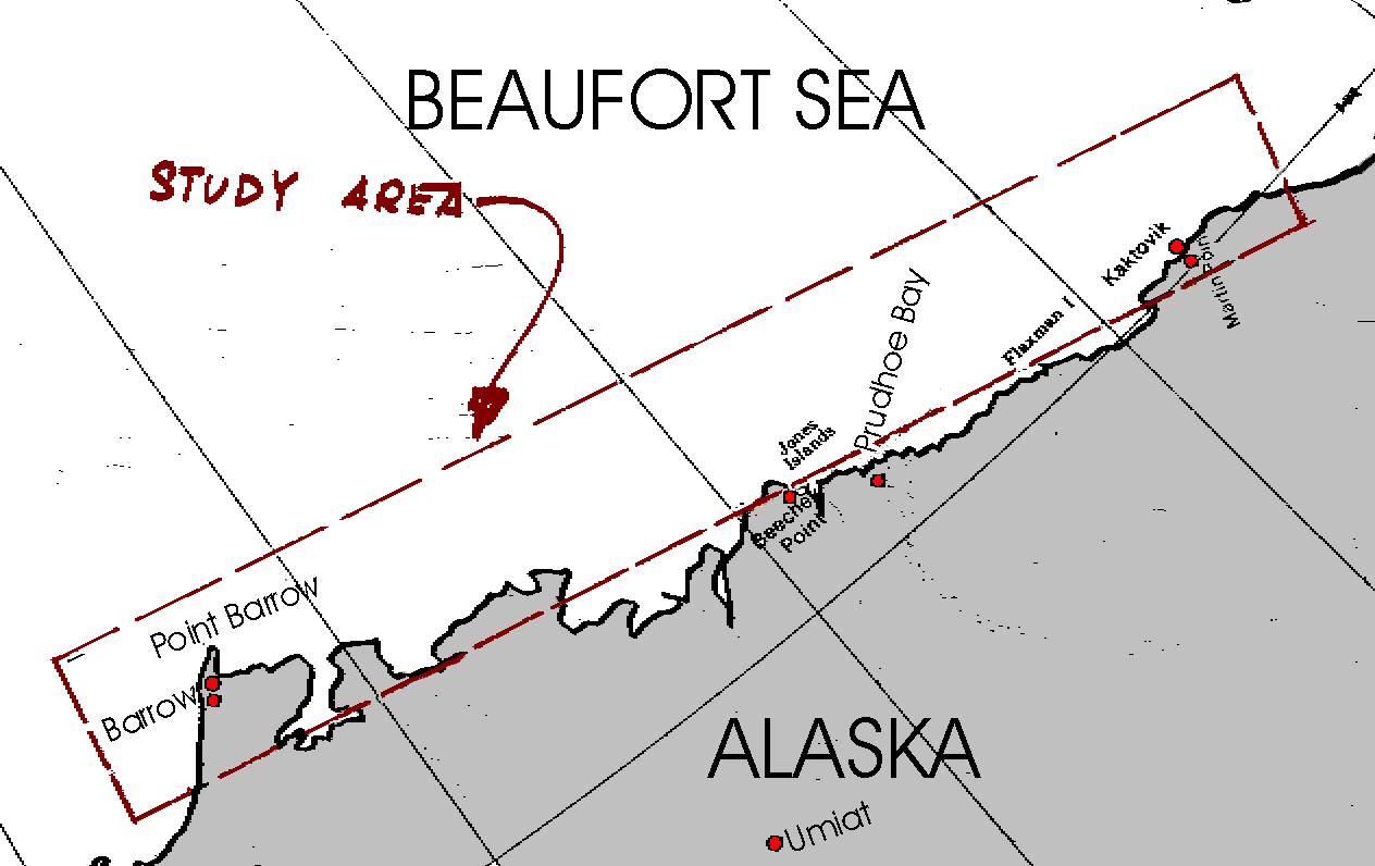
Prudhoe Bay Area DESCRIPTION: An aerial remote sensing, interpretation, and analysis program was carried out in order to generate information on ice break-up in the Prudhoe Bay area (Figure 1) in the Spring of 1980. The acquisition program consisted of the utilization of SLAR and aerial cameras for the acquisition of strategic imagery in the study area. Ancillary programs were included for groundtruthing, visual aerial observation by expert observers, and 35 mm photography. The SLAR overflight program consisted of a series of 9 sequential overflights to gather SLAR imagery in a 50 mile wide strip adjacent to the coast from Point Barrow to Barter Island, and several other special overflights both seaward into the multi-year pack and over designated near-shore areas.
The imagery output consisted of complete SLAR coverage prints,
mosaics, 400 planimetric aerial strip photographs, and numerous
35 mm prints and slides. The information yield, in addition to
the imagery itself, consisted of the results of several levels
of interpretive work, ranging from descriptive pictorial outputs
to rigorous numerical results. The general interpretation
program consisted of the generation of descriptive overlays for
all the SLAR imagery. Quantitative interpretation results were
generated utilizing a Bercha Group software package, yielding
ice morphology and dynamics parameters statistically describing
floe and feature characteristics, velocity fields, and other
statistical and probabilistic parameters for the ice cover.
Results of the numerical work were summarized in tabular and
graphical format, adequately characterizing many of the
mesoscale ice morphology and dynamics characteristics and their
distributions throughout the break-up period over the spatial
field of the survey area. Additional
|
||||||||||||
| R8007 |
Assessment
of Relative Merits of Microwave and Visual Spectrum Sensing
Techniques for Evaluation of Environmental Impact Parameters
Berok Systems Limited |
||||||||||||
| R8003 |
Comparative Study of Landsat, SLAR, and SAR Imagery for
Quantitative Evaluation of Lineament Distributions and Gradients
in the North Central Plains Conoco Exploration Company |
||||||||||||
| R8002 |
Acquisition and Interpretation of Multi-Sensor Imagery (SLAR,
TIR, FCIR, MSS) For Assessment of Seasonal Variations in
Rangeland Biomass Department of Agriculture |
||||||||||||
| R8001 |
Ice and
Sea Model for Baffin Bay and Lancaster Sound Petro-Canada Resources |


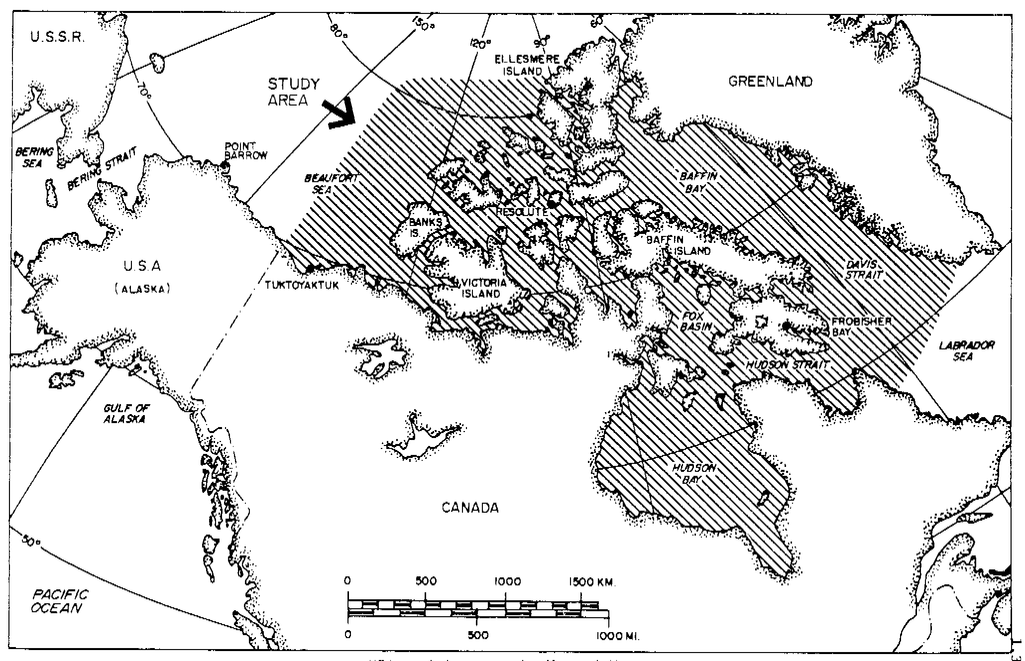
![]()
This page and all contents are Copyright © Bercha Engineering Limited. Website updated: January 31, 2013